Map of the Battle
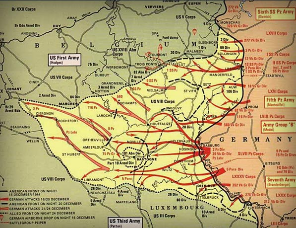
The Battle of the Bulge map, this map shows off the location of the attacks, and the paths of war that were used during the battle. The Battle of the Bulge started on December 16th 1944. Hitler had convinced himself that the alliance between Britain, France and America in the western sector of Europe was not strong and that a major attack and defeat would break up the alliance. Therefore, he ordered a massive attack against what were primarily American forces. The attack is strictly known as the Ardennes Offensive but because the initial attack by the Germans created a bulge in the Allied front line, it has become more commonly known as the Battle of the Bulge. Hitler’s plan was to launch a massive attack using three armies on the Allies which would, in his mind, destabilise their accord and also take the huge port of Antwerp through which a great deal of supplies was reaching the Allies.
